
web site consulting by ingenious, inc.
Reprinted with permission as a public service by the Landmark Society of the Niagara Frontier, now the Preservation Buffalo Niagara
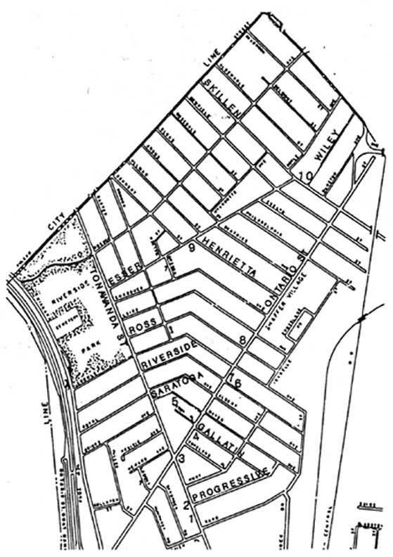
Riverside
MAP
Taking its name from the Riverside A.C. club, a social organization of hunters and fishermen once located on Niagara and Ontario Streets, the Riverside district primarily served as a rural retreat from the city. Prior to 1890 a few scattered homes existed and the majority of the residents were wealthy owners of large, private estates.
Speculation in the development of the area first occurred in 1888 with the city's passage of the Hertel Avenue Sewer Bill. With its enactment and the 1892 extension of Niagara Street from Hertel Avenue to the city line, the area became a prime target for development.
By 1890, the North Park Land Company had purchased over thirty acres of land in the vicinity of Germania Park, now Riverside Park, and began constructing two-family homes there. By 1900, over 2,000 people resided in the area.
Riverside, with its broad expanses of land and sweeping views of the Niagara River and Canada, quickly caught the interest of people desiring to reside in the suburban setting. A large number of Canadians settled there, joined by Germans and Irish from Black Rock.
Black Rock Land Company: The earliest developer of the area, the Black Rock Land Company, formed in 1888 as the first development company in the city. Comprised of John Hertel, John Esser, Frank Angus, Louis Roesch and Frederick Ullman, they sold the current site of RiversidePark, the former Germania Park to the city, for inclusion in the Buffalo Parks System. The names of many streets in the areareflect their influence here.
Roblin Brothers: With the close of the Pan American Exposition of 1901, the Roblin Brothers began the second wave of development in the area. Using lumber from buildings being demolished on the Exposition grounds, they constructed hundreds of homes in the Ontario/TonawandaStreet area on Briggs, Riverside, Laird, Crowley and Ross Streets.
The remainder of the area developed between the Depression of the1930s and World War II. With the city and country in a ma]oreconomic slump, the suburban growth had slowed and development in the area increased.Thruway: The area retained its close association with the river until the1.950s. In 1958, construction of the Niagara Section of the Thruway on the site of the Erie Canal towpath obliterated the boat houses, docks and social clubs of the area and severed its ties with the Niagara River.
© 1995 James Napora
Page by Chuck LaChiusa with the assistance of David Torke
| ...Home Page ...| ..Buffalo Architecture Index...| ..Buffalo History Index... |.....E-Mail ...| .