![]()
Niagara Street Industrial Heritage
Russ's Bait and Tackle
1226 Niagara St., Buffalo, NY
Built: c. 1885
First business: Drug store
Status: Contributing member in the Upper Black Rock Local Historic District
![]()
Niagara Street Industrial Heritage
Russ's Bait and Tackle
1226 Niagara St., Buffalo, NY
Built: c. 1885
First business: Drug store
Status: Contributing member in the Upper Black Rock Local Historic District
|
1226 Niagara Street
The Buffalo Common Council approved the “Upper Black Rock Historic Preservation District” as the City’s newest designated district on April 28th. The District is a collection of properties that are a significant cultural landscape and historic resource along Niagara Street, Mason Street, the Belt Line Rail Road and Black Rock Canal. The district is adjacent to the Black Rock Canal, a National Register Eligible resource and part of the Erie Canal National Heritage Corridor. The following information ... from the National Register District Inventory Form that documents the significance of the resource and is a preliminary step in the National Register nomination process. It was prepared by Carmina Wood Morris and Kerry Traynor of kta preservation specialists last summer. The properties on the west side of Niagara Street have two “faces”. Their west elevations face the Belt Line Rail Road and what was historically the New York Central Rail Road (now CSX and Amtrak), and the Black Rock Canal, while their east elevations face Niagara Street. The properties between Breckenridge Street and Auburn Avenue also face a short alley known as Mason Street. The Upper Black Rock Historic Preservation District embodies the relationship between industry and transportation networks on water and land that defines the history of the Village of Black Rock, specifically Upper Black Rock. Transportation related commerce and industry were defining factors in the history of the area. The historic district conveys the industrial history of Upper Black Rock by water, rail and truck along the Black Rock Canal, Belt Line Rail Road and Niagara Street. 1226 Niagara Street is located on the northwest corner of Niagara and Breckenridge Streets. The three story, three bay brick commercial building was constructed ca. 1885 and is noted as a drug store on the 1889 Sanborn map. John C. Prong lived at 1226 Niagara Street and opened a boot and shoe repair shop in the retail space, a business he maintained at this location for thirty-years. The property has a history of long term tenants. In 1961 a bait store, which remains today, occupied the storefront. The building is simply detailed. The storefront has been infilled with brick, however the corner cast iron column and signboard remain. An oriel bay window on the south elevation is documented on the 1889 map, and the addition to the west appears by 1916. The simple composition is terminated by a scalloped corbeled frieze. - Upper Black Rock Historic Preservation District. Reprinted on Meet the Upper Black Rock Historic Preservation District on Buffalo Rising, May 26, 2015 (online June 2017) |
The 1889 Sanborn Fire Insurance Map also documents the retail properties remaining extant in the Upper Black Rock Historic District, which would have provided everyday necessities for the working class community:
- Upper Black Rock Historic Preservation District |
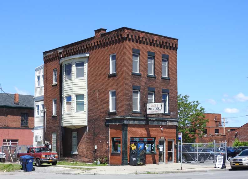 Northwest corner of Niagara and Breckenridge Streets 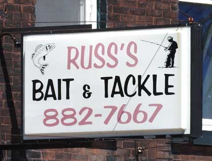 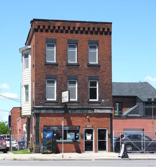 3-bay building ... Cast iron columns in storefront 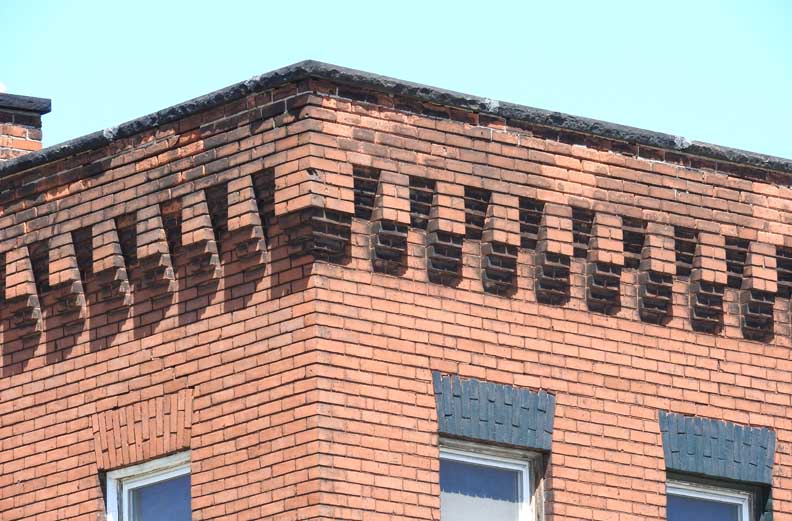 Corbel table 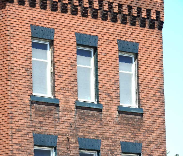 Voussoirs above windows ... Stone(?) sills 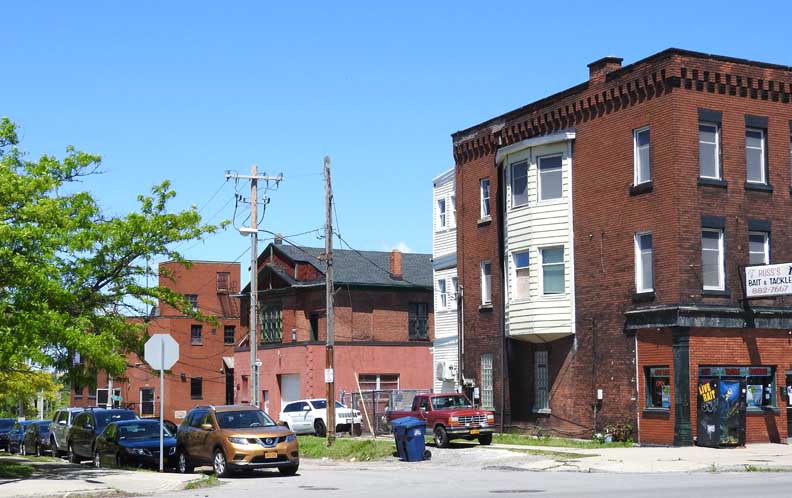 Breckenridge Street ... 44 Breckenridge is the oldest church building in the city: Union Meeting House/Breckenridge St. Presbyterian Church 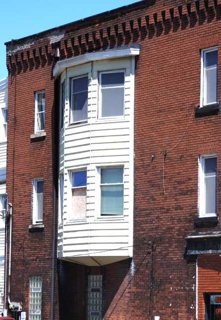 Oriel, without a supporting corbel 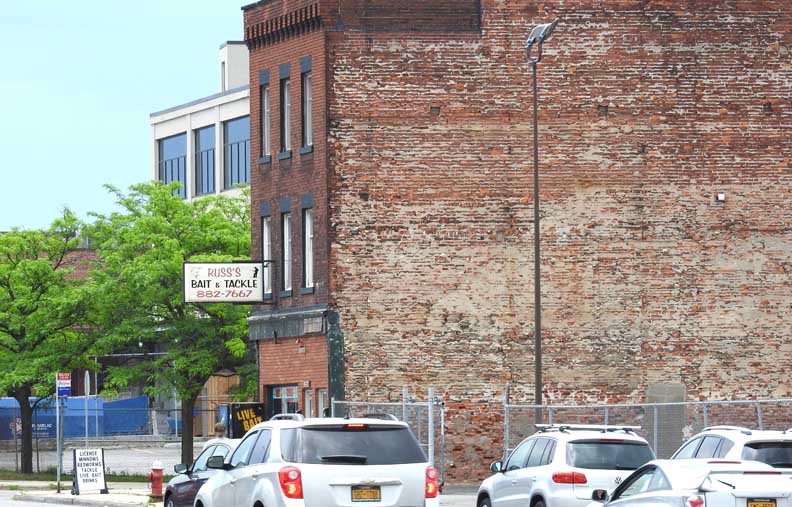 At one point in time, adjacent to another bjuilding |